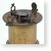
A crucially important figure in sieges and on battlefields was the cartographer, who drew up maps of fortresses and territories. Starting from the early 16th century, one of the fundamental topographic instruments was the magnetic compass, consisting of a magnetized needle pivoting at the centre of a graduated disk divided into eight sectors and carrying a diopter. Each sector corresponded to the directions of a wind. This instrument had numerous variants: the theodolite, planimeter, holometer and graphometer.
Alidade
Inv. 3603
Francesco Morelli, Rome, 1788
Del modo di misurare le distantie…, Cosimo Bartoli (facsimile)
Firenze, Museo Galileo, Rari 120
Cosimo Bartoli, Venice, original 1564 / facsimile 2008
Graphometer
Inv. 245, 3699
Domenico Lusverg, Rome, 1710
Graphometer
Inv. 151
Maker unknown, 17th cent.
Graphometer
Inv. 3630
"Ring", Berlin, 18th cent.
Level
Inv. 701
Domenico Lusverg, Rome, 1710
Odometer
Inv. 648
Maker unknown, 17th cent.
Surveying compass
Inv. 2506
Matteo Botti, Giovanbattista Botti, Italian, 17th cent.
Surveying compass
Inv. 3371
Maker unknown, 17th cent.
Surveying compass
Inv. 1279
Maker unknown, 17th cent.
Surveying compass
Inv. 2508
Maker unknown, Italian, 17th cent.
Surveyor's square
Inv. 681
Domenico Lusverg, Rome, 1710
Surveyor's square
Inv. 680
Maker unknown, Urbino, 1654
Theodolite
Inv. 149
Maker unknown, 17th cent.


