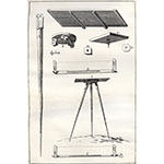
Graphic and quantitative description of topographic features for the purpose of obtaining an accurate image of parts of the Earth's surface. The scientific foundations of surveying date from the 16th C., when graphometers, levels, theodolites, and other surveying devices reached a considerable level of precision. Almost all these instruments are fitted with a magnetic compass for orientation.
Related objects


