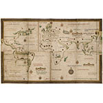
This planisphere, one of the oldest Portuguese maps extant, represents the coastal limits of the known world in the mid-sixteenth century. It is the first map to show Argentina, designated as "Terra Argentea." Dated and signed by the famous Portuguese cartographer Lopo Homem on the lower right.
Authors
Typology
Context


